

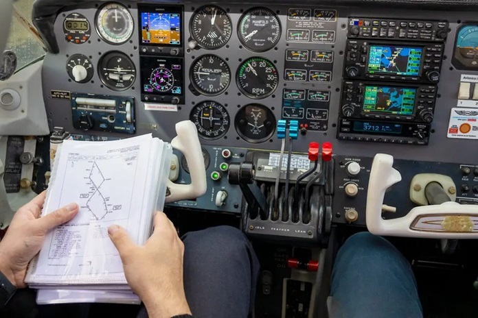
Navigation may not be the most glamorous aspect of aviation, but it’s arguably the most important. Even in an era of instrument cockpit displays and electronic flight bags (EFBs), printed Visual Navigation Charts (VNCs) are still the most reliable means of directional orientation and terrain awareness that pilots have.
VNCs, along with a wide range of Australian, Enroute, and World Planning charts are used to provide the aeronautical and topographical information that pilots need to stay informed about air routes, as well as controlled, uncontrolled, and even restricted air spaces. Printed paper charts offer the time-tested visual navigational references that pilots have relied on since the earliest days of Australian flight, but they’re useless if they’re not current and up-to-date. Airservices Australia is the Government-operated agency that’s responsible for the safety of Australia’s skies, and it’s no coincidence they’re also the source of the country’s most accurate maps and charts.
Pilots Trust Airservices Australia for Risk-Free Printed Navigation Charts
Although today’s portable GPS-, and EFB-based charting apps and programs are more accurate and affordable than ever, the fact is, not all pilots need, or are especially comfortable with electronic navigation. That’s why ICAO (International Civil Aviation Organization) spec Airservices Australia charts and maps continue to be used as the qualified primary, as well as the back-up navigation resource for so many of the country’s private and recreational pilots.
Unlike the small, easily obscured views of electronic charts when displayed on iPads or Android tablets, paper aeronautical charts give pilots an instant, unhindered view of the track their flying. There’s no swiping, resizing, or anything else that could cause a pilot to have a critical lapse in attention, and can be conveniently folded up and tucked into a map pocket the moment it’s not needed. Paper charts also eliminate the need for recharging, as well as the risk of technical gliches or hardware failures.
The Most Up-to-Date Charts and Maps Keeping Australia’s Airspace Safe
Of the 13,000 fixed- and rotary-wing aircraft registered in Australia, more than 92% of them are registered for non-scheduled charter services, and general aviation jobs ranging from agricultural mustering and spraying, to pipeline and powerline surveying. These operations are overwhelmingly conducted under visual flight rules (VFR), and the pilots flying them have to be sure that the Australian airspace charts they’re using are the most recent publications.
Airservices Australia VFR charts and maps are updated every 6 months, and contain the fullest set of directional, and VNC data available for publication, including:
- Visual Terminal Charts (VTCs). VTCs provide aeronautical and topographical information at a scale of 1:250,000 for VFR operations near controlled aerodromes and landing spaces, including tracks flown and landmarks.
- Enroute Charts (ERCs) High (H) and Low (L). ERCs are drawn in various scales, and are designed to display air traffic routes, along with airspace restrictions, above (H) or below (L) FL200.
- Terminal Area Charts (TACs). TACs are designed for use around congested terminal areas, and to provide large scale information on air routes, prohibited and restricted areas, as well as radio freqs in Class B airspaces.
- World Aeronautical Charts (WACs). By using 1:1,000,000 WAC charts, Australia pre-flight planning, as well as pilotage by line of sight and VFR navigation are both safer and easier than ever.
- Visual Navigation Charts (VNCs). With topographical information at a scale of 1:500,000, VNCs allow flight planning in relation to controlled airspaces, as well as when transitioning from the WAC to VTC.
Make no mistake: even when flying through the country’s uninhabited interior airspace, Civil Aviation Regulations still require pilots to have the most up-to-date navigation resources onboard their aircraft for both their primary, as well as their alternate flight paths. That’s why even the most remote aviation and airspace operators trust Airservices Australia’s Australian airspace map and chart data to keep the country’s airspaces operating safely and efficiently.
The Importance of Chart Data for Operators Other Than Pilots

Although Airservices Australia’s maps and charts are navigational cornerstones for the full range of private and recreational pilots, they’re not the only ones who benefit from, or are required to consult updated aeronautical charts. Australia sets airspace standards for a host of other operators whose jobs revolve around general aviation, including:
- Commercial drone and UAV (unmanned aerial vehicle) operators. Not only does the Civil Aviation Safety Authority (CASA) require commercial UAV operators to hold a Remote Pilot License (RePL), they’re also expected to know how to read VNCs.
- Balloon and airship operators. Balloons and airships are used for everything from advertising and aerial photography to sightseeing and pleasure riding, and proficiency in chart reading is a mandatory qualification for licensed operators to avoid controlled airspaces.
- Certified aerodrome, and landing area operators. While aerodrome operators aren’t chart users themselves, they’re required to ensure the integrity of important chart data relating to them, like topographical and approach changes, the removal or addition of obstacles, and changes in take off and landing minimums.
You can even purchase printed CASA manuals outlining all the procedures, infringement hotspots, and tracking points that VFR operators need to be aware of when entering two of Australia’s most challenging controlled environments: Brisbane and the Gold Coast. These areas make up two of the most unique mixes of IFR (instrument flight rules) and VFR traffic in the world, and up-to-date chart availability and knowledge are paramount.
The Final Word
At the end of the day, while maps and charts may seem outdated in an industry that’s dominated by mounted and portable IFR resources, they’re indispensable navigational references for a wide selection of aviation professionals. Not everyone wants the risk and equipment costs that go with electronic devices though, which is why the straightforward durability of paper continues to see the broad usage.


